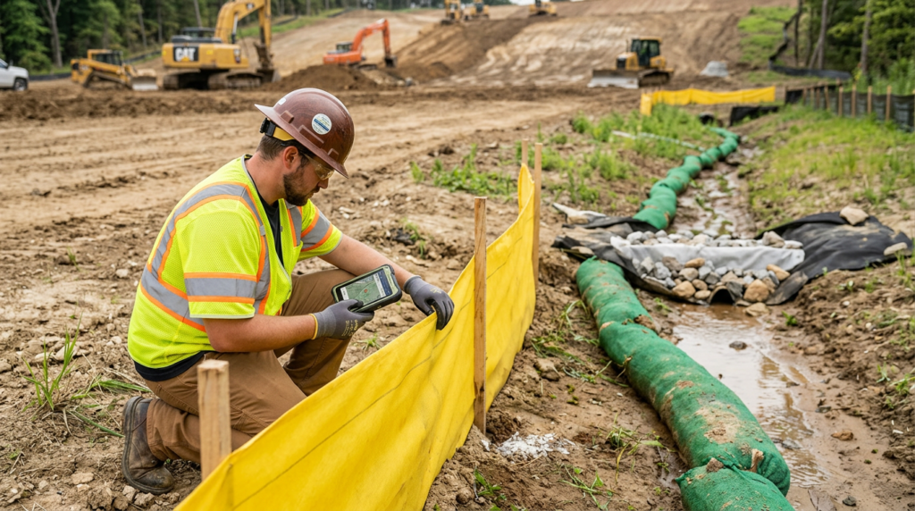
Quick answer: You usually need an erosion and sediment control plan when your project will disturb soil and could send muddy runoff into streets, storm drains, wetlands, or neighboring properties. Many towns and conservation commissions require one for grading, new driveways, additions with excavation, new construction, and utility work. A solid plan shows how you’ll keep soil on-site during construction and stabilize the site afterward.
What the Plan Covers in Plain English
An erosion and sediment control plan is a set of drawings and notes that shows how runoff will be managed during construction so soil doesn’t wash away. It typically identifies drainage patterns, where water will concentrate, and which areas will be exposed at each phase of work.
Quick decision checklist: (1) Will you disturb soil (excavation, grading, trenching, driveway base)? (2) Can runoff reach a catch basin, ditch, stream, or wetland from the work area? (3) Are there slopes that can carry sediment—many reviewers start paying closer attention once slopes are roughly in the 10%–15% range, and concerns increase as slopes get steeper (typical guidance; local standards vary). (4) Are you pulling permits through a conservation commission, planning board, DPW, or state agency? If you hit “yes” on soil disturbance plus any pathway to water or a permit board, you’re commonly in plan territory. Thresholds vary by municipality/state, and NPDES construction stormwater coverage (where applicable) is often tied to disturbed acreage, so the same project can be treated differently in different places.
Most plans specify temporary measures (like silt fence, compost filter socks, inlet protection, construction entrances, temporary seeding, and stockpile controls) and permanent stabilization (like loam and seed, mulch, erosion control blankets, riprap at outlets, and restoring vegetation). It also lays out sequencing: clearing limits, how long soil can stay exposed, and what gets installed before excavation starts.
Standard details fail when they’re copied without matching the site: a silt fence line drawn across a swale gets overtopped, a filter sock placed in concentrated flow washes out, or an inlet protection detail is shown where the catch basin sits in a low spot and floods the work area. Plans work better when they show where water actually wants to go and how you’ll intercept it before it picks up sediment.
Common Triggers That Make One Required
Requirements vary by municipality, but the same triggers come up again and again: visible soil disturbance, work near wetlands or water bodies, steep slopes, and any work that can affect public drainage systems. Even smaller jobs can be flagged if runoff would flow toward a catch basin, a neighbor’s driveway, or a low spot that already ponds.
Typical projects that often need a plan include new homes, additions with foundation work, driveway construction, regrading, septic installations, retaining walls, and site utility trenches. If permits involve a conservation commission, planning board, building department, or an NPDES construction stormwater permit, an erosion and sediment control plan is commonly part of the submittal package.
What to gather before you call the reviewing office or an engineer: a base site plan (or plot plan), the limits of disturbance, proposed grading or spot elevations (even a sketch helps), where soil stockpiles will sit, and the nearest catch basins, ditches, streams, or wetlands relative to the work. Having a few photos of existing slopes and low areas also makes the conversation faster.
What Reviewers and Inspectors Look For
Reviewers want to see that the plan prevents sediment from leaving the site and that it’s buildable. Clear installation details matter: where the silt fence turns uphill, how outlets are armored, how construction entrances prevent tracking mud onto the road, and how catch basins are protected without blocking drainage.
Inspectors also focus on maintenance. Controls fail when they’re not maintained—silt fence buried in sediment, filter socks washed out, or stabilized construction entrances that turn into mud. A plan should spell out who checks controls, how often (often tied to rain events and active work), and what “fix it” thresholds look like. One common trigger (varies by jurisdiction and product) is removing sediment when it reaches roughly one-third to one-half the height of a silt fence or berm, or when sediment is close enough to overtop during the next rain.
Phasing is another big one. Stabilize exposed soil as soon as practical and before forecasted storms. Reviewers like to see limits of clearing, temporary stabilization called out for pauses in work, and a clear path to final stabilization so the site isn’t left bare between trades.
How to Get a Plan That Actually Works on Site
Start by mapping the flow of water, not just the property lines. The best plans keep uphill “clean” runoff out of disturbed areas, keep disturbed areas as small as practical, and provide a stable discharge point so concentrated flow doesn’t cut a new channel.
Coordinate early with the contractor. A plan that blocks access or ignores equipment paths tends to get changed in the field in ways that create problems. Ask for controls that fit the construction sequence and equipment, and make sure the plan shows stockpile locations, concrete washout (if applicable), and where materials will be staged.
If you want help tailoring the plan to your site and local review expectations, Haughawout Engineering & Markets is a good place to start.